Topic: environmental monitoring
-

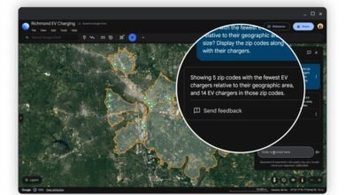
Ask Google Earth Anything with New AI Features
Google Earth now integrates advanced AI, allowing users to ask complex questions and receive data-driven answers to identify infrastructure at risk from storms or vulnerable communities. The upgrade is powered by Google's Gemini technology, which links Earth AI models like weather forecasts and s...
Read More » -
Google Earth's New AI Helps Map the Climate Crisis
Google has developed an AI-powered mapping tool that visualizes environmental changes and predicts future climate risks, making complex planetary data accessible through simple queries. The system, built on the AlphaEarth Foundations AI model, processes satellite imagery to create actionable info...
Read More » -
Dubai Ports Debuts First Smart Drone System to Boost Safety
The Dubai Ports Authority has launched "Port Eye," an autonomous drone system using AI and 4K thermal imaging to enhance safety, inspections, and environmental monitoring in Dubai's ports. This system significantly reduces inspection times from four hours to fifty minutes and improves efficiency ...
Read More » -
UAE Pours $12 Billion Into Booming Private Space Sector
The United Arab Emirates is investing $12 billion into its private space industry to strengthen its global position through a collaborative model of government support and private enterprise. The UAE's space sector is experiencing significant growth, with a doubling of SME participation and incre...
Read More » -
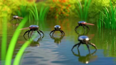
Insect-Inspired Robots Walk on Water, Revolutionizing Disaster Response
Scientists have developed insect-inspired robots that can walk on water using a new fabrication method called HydroSpread, which allows direct formation of polymer films on water for improved precision and reliability. Two prototypes, HydroFlexor and HydroBuckler, are powered by remote infrared h...
Read More » -
TakeMe2Space and AICRAFT Launch First Orbital Data Center
TakeMe2Space and AICRAFT are partnering to launch the first orbital data center, with a 2026 mission to demonstrate high-performance computing in space and integrate AI capabilities into the TM2S satellite constellation. The collaboration will enable real-time, on-orbit processing of Earth Observ...
Read More » -
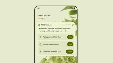
Google Home App Gets a Major Gemini-Powered Redesign
The Google Home app is being redesigned with Gemini integration to enhance conversational control and provide a more intuitive user experience through natural language interaction. A new "Ask Home" search bar allows users to type or speak commands to control devices, review video history, and che...
Read More » -
Oman Set to Launch Second High-Res Satellite by 2026
Oman plans to launch a second high-resolution satellite by 2026, achieving 50-centimeter resolution to enhance Earth observation capabilities as part of Oman Vision 2040. The new satellite builds on the success of OL-1, Oman's first optical satellite launched in 2024, which provided one-meter res...
Read More » -
Oman to Launch First High-Tech Satellite in 2026
Oman will launch its first high-tech satellite in the first half of 2026, marking a major milestone in its digital and scientific advancement. The satellite features high-resolution imaging and onboard AI for real-time data processing, enabling detailed Earth observation and faster insights. It w...
Read More » -
From Station Platforms to Smart Hospitals: How Hong Kong’s Tech Projects Are Quietly Reshaping Daily Life
From AI‑powered hospitals to autonomous shuttles, Hong Kong’s smart city projects are grounded in real institutions and measurable results. This fact‑checked report shows how government, research hubs, and companies are making daily life more efficient, connected, and sustainable.
Read More » -
Google DeepMind's AI Maps Earth with Unprecedented Precision
Google DeepMind's AlphaEarth Foundations is a groundbreaking AI system that maps Earth's surface with unmatched precision, enabling better environmental monitoring, urban planning, and resource management. The system integrates diverse satellite data into a unified model, reducing error rates by ...
Read More » -
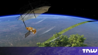
Stunning 'Space Umbrella' Images Reveal Earth's Forests
The Biomass satellite, equipped with the first space-based P-band radar, provides unprecedented insights into Earth's forests by measuring carbon storage and penetrating dense canopies with high precision. Developed by Airbus and ESA, the satellite's advanced radar technology maps forests, underg...
Read More »