Stunning ‘Space Umbrella’ Images Reveal Earth’s Forests
▼ Summary
– The Biomass satellite, equipped with European technology, has captured its first images of Earth’s surface, focusing on detailed forest carbon measurements.
– Built for ESA by aerospace companies, Biomass launched in April from French Guiana and features the first P-band radar in orbit to study forest carbon storage.
– The P-band radar uses long wavelengths to penetrate forest canopies, mapping woody structures where carbon is stored, as well as subsurface geology and ice sheets.
– Biomass orbits Earth at 666 km, sending radar data to ESA’s Kiruna station for processing into biomass density maps and forest height models accessible via the MAAP platform.
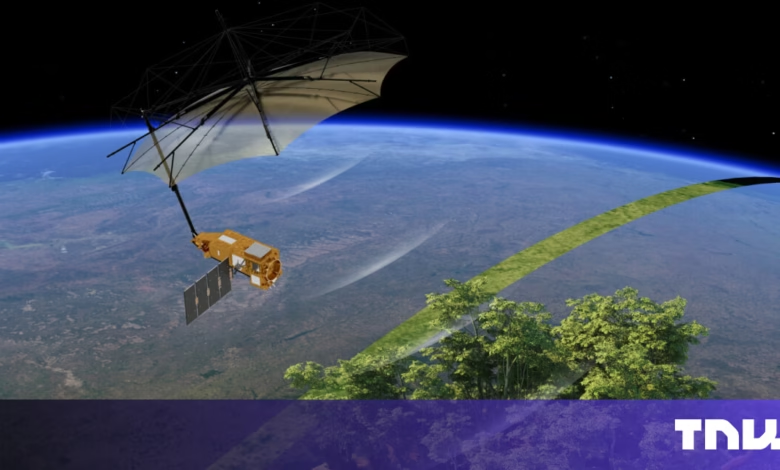
– The satellite’s umbrella-like antenna, built by L3Harris, directs radar pulses to Earth and captures returning signals to create detailed 3D maps of global biomass and landscape features.
A groundbreaking satellite equipped with advanced European technology has captured its first breathtaking images of Earth’s forests, offering unprecedented insights into global carbon storage.
The Biomass satellite, developed through a collaboration between aerospace leaders and innovative startups for the European Space Agency (ESA), blasted into orbit in April aboard a Vega-C rocket from French Guiana. This mission marks a major leap in environmental monitoring, as it carries the first P-band radar ever deployed in space, designed to penetrate dense forest canopies and measure carbon stored in woody biomass with unmatched precision.
Constructed by Airbus, the satellite’s radar technology uses long wavelengths to peer beneath leafy surfaces, revealing the hidden structures where forests lock away carbon. Beyond tracking deforestation and regrowth, the probe can also map underground geology, ice sheet formations, and intricate terrain details invisible to conventional satellites.
One striking early image showcases Bolivia’s Rio Beni winding through lush rainforests, with colors highlighting distinct ecosystems, green for dense forests, red for floodplains, and blue-purple for grasslands. These visuals are made possible by the radar’s polarization channels, which decode landscape features in vivid detail.
Orbiting 666 kilometers above Earth, Biomass beams raw data to ESA’s ground station in Sweden, where it’s processed into high-resolution biomass maps and 3D forest models. Scientists worldwide can access this treasure trove of information via the Multi-Mission Algorithm and Analysis Platform (MAAP), a cloud-based system developed by Belgian firm Spacebel. This eliminates the need for cumbersome downloads, streamlining global research on climate change.
A key component of the mission is the satellite’s umbrella-like antenna, engineered by L3Harris in the U.S. This structure directs radar pulses toward Earth and captures the returning signals, enabling the creation of intricate 3D reconstructions of forests and other landscapes. Early images from Indonesia’s Halmahera archipelago demonstrate how the radar penetrates foliage to expose underlying topography, offering clues about forest health and terrain.
By delivering unprecedented detail on carbon stocks and ecosystem dynamics, Biomass is set to revolutionize our understanding of Earth’s forests and their role in the planet’s carbon cycle. The mission underscores the power of cutting-edge space technology in addressing pressing environmental challenges.
(Source: The Next Web)