Google DeepMind’s AI Maps Earth with Unprecedented Precision

▼ Summary
– Google DeepMind introduced AlphaEarth Foundations, an AI system that transforms Earth observation by integrating vast satellite data into a unified digital representation.
– The system reduces error rates by 23.9% and requires 16 times less storage than other AI solutions, lowering costs for planetary-scale environmental analysis.
– AlphaEarth Foundations uses “embedding fields” to compress satellite data into 10-meter summaries, maintaining precision for applications like urban planning and deforestation tracking.
– Over 50 organizations, including MapBiomas and Global Ecosystems Atlas, are already using the system for real-time environmental monitoring and conservation planning.
– The AI is available through Google Earth Engine, democratizing access to high-resolution, global environmental data while balancing utility and privacy.
Google DeepMind has unveiled a groundbreaking AI system capable of mapping Earth’s surface with unmatched precision, offering transformative potential for environmental monitoring, urban planning, and global resource management. This innovation, known as AlphaEarth Foundations, tackles a long-standing challenge in satellite data analysis, converting vast, fragmented datasets into coherent, actionable insights.
Traditional satellite imaging produces terabytes of data daily, but synthesizing this information into meaningful patterns has been a persistent hurdle. AlphaEarth Foundations acts as a “virtual satellite,” integrating diverse Earth observation sources into a unified digital model. The system achieves a 23.9% reduction in error rates while requiring 16 times less storage than comparable AI solutions, making large-scale environmental analysis more accessible and cost-effective.
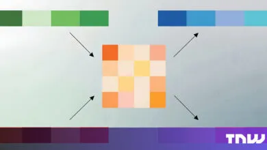
At its core, the technology relies on “embedding fields”, highly compressed summaries that capture essential surface characteristics in 10-meter grids. This level of detail enables tracking of small-scale changes, from urban development to deforestation, without sacrificing accuracy. Unlike conventional methods, the AI maintains sharp resolution while handling temporal gaps, such as cloud-obscured imagery, by intelligently interpolating missing data.
Early adopters are already seeing dramatic improvements. In Brazil, MapBiomas leverages the system to monitor Amazon deforestation in near real-time, significantly enhancing mapping speed and precision. Meanwhile, the Global Ecosystems Atlas initiative uses it to classify previously uncharted regions, aiding conservation efforts worldwide.
For enterprises, the implications are profound. AlphaEarth Foundations excels in “sparse data regimes,” reducing reliance on costly ground surveys. In one test, it outperformed other models in estimating evapotranspiration rates, a critical metric for agriculture, achieving an R² value of 0.58, where competing methods failed entirely.
Google has integrated the system into its broader Earth AI suite, which includes weather prediction and wildfire detection tools. The accompanying Satellite Embedding dataset, available via Google Earth Engine, spans 1.4 trillion data points annually from 2017 to 2024, offering historical context for environmental trends.
Privacy remains a priority, the 10-meter resolution ensures individual structures or people aren’t identifiable, balancing utility with ethical considerations. By democratizing access to planetary-scale intelligence, Google DeepMind’s innovation empowers organizations to make data-driven decisions with unprecedented clarity, whether tracking crop health, verifying sustainability claims, or optimizing urban growth.
The message is clear: in an era where environmental and logistical challenges demand smarter solutions, AI-powered Earth observation is no longer optional, it’s essential.
(Source: VentureBeat)